

Day 12: 20 August 2013: Upshi to Keylong
We wake up at around 0610 hrs. Since we are in no mood to freshen up as “Bahar Accha” as advised by the owner of the room, we decide to leave Upshi as early as possible and freshen up wherever we get some decent facility. So we have our morning tea from another shop and hop on the car. The Sun is yet to rise behind the mountains…


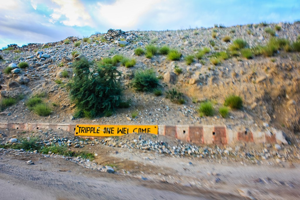
We cross bridge and leave Indus river behind. The Indus goes along the road to Tso Moriri and we are not going there. Tripple One welcomes us…
A board gives us the distances…

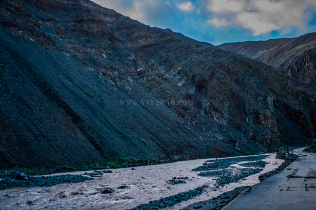
Though we have left Indus behind, we’re not without a stream with us. A rivulet, a tributary to Indus gives us company…
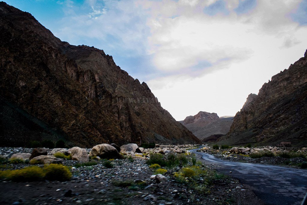
The vistas are changing from brown to Black with unique structures… there is more greenery with us and we are quickly passing small hamlets..


The valley is opening up and soon we cross Lato village…

Chortens are all around.. of course they’re in abundance in Ladakh…


Soon we cross Rumtse and gradually the rivulet is parting ways…

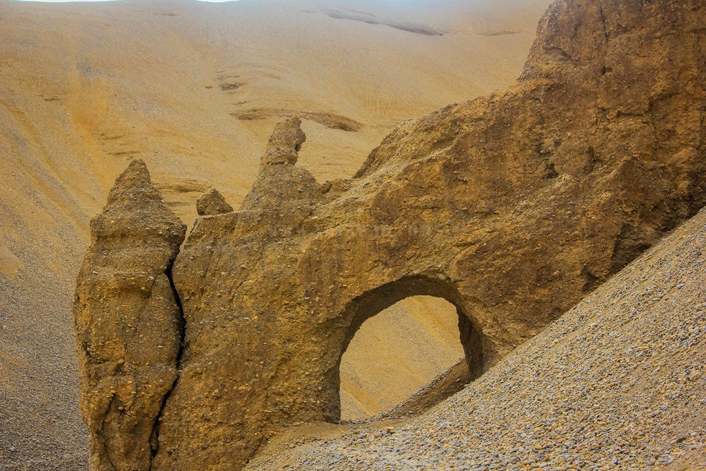
There are some strange formations on the other side of the rivulet – multiple chortens or natural act of Wind and Rains?

Another board reminds us the distances…

The peaks still have some snow. Within a month or so, they’d start getting abundance of it..

The road is Ok and the Sun is playing hide-n-seek…

Another set of chortens. By design of it, it seems that the previously seen structures were also chortens only, though the wind and rains have taken their toll.

Gradually we are gaining height, but not as much that we can soar in the sky…

And suddenly, the scene changes. Beautiful is it and we keep on clicking through our eyes. One for the camera as well 🙂


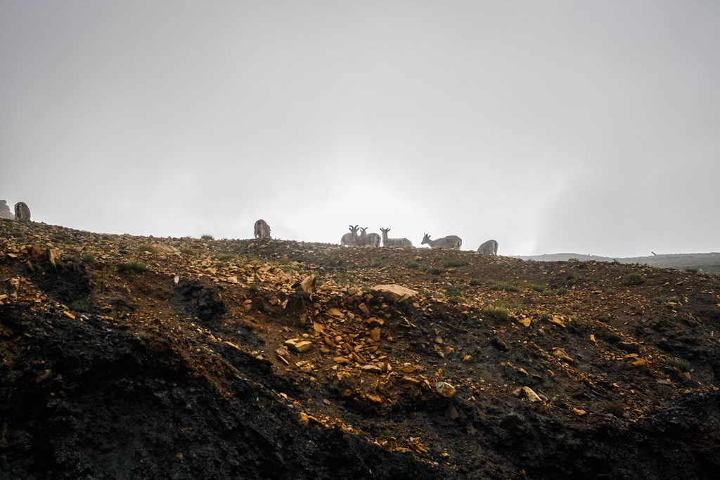
A herd of ibex is foraging…
Driving ahead and gaining altitude, we soon reach to a place which is claimed to be the second highest mountain pass in the world – Tanglang La. Well, statistics debate that and say it is doubtful, but who cares?
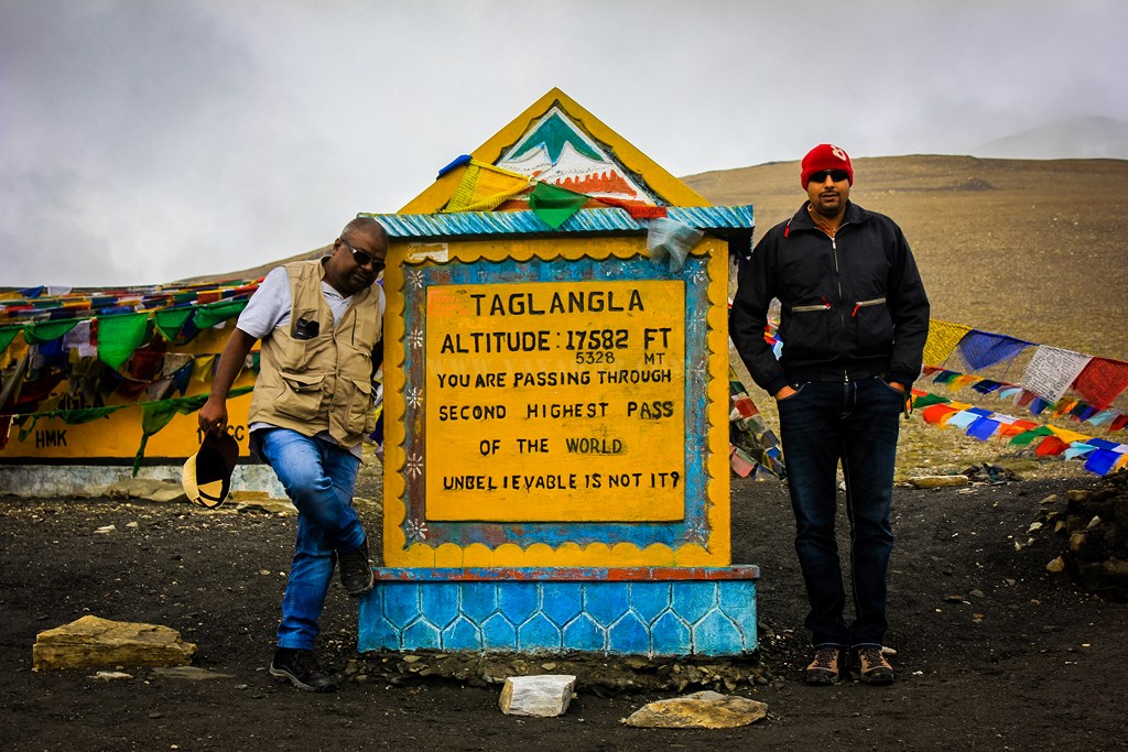

We spend sometime to grasp the nature, the wind, the cold environment. Views from here are astounding!

Coming down from Tanglang La, after some water crossings, we reach Debring camps and have some tea. Conscious of the fact that we haven’t yet got a chance to freshen up, we don’t eat anything here.


There is a road which goes to Tso Kar from just ahead of Debring… we do not take that as we have to reach Chandratal by tomorrow and hence we must reach Keylong by evening today.
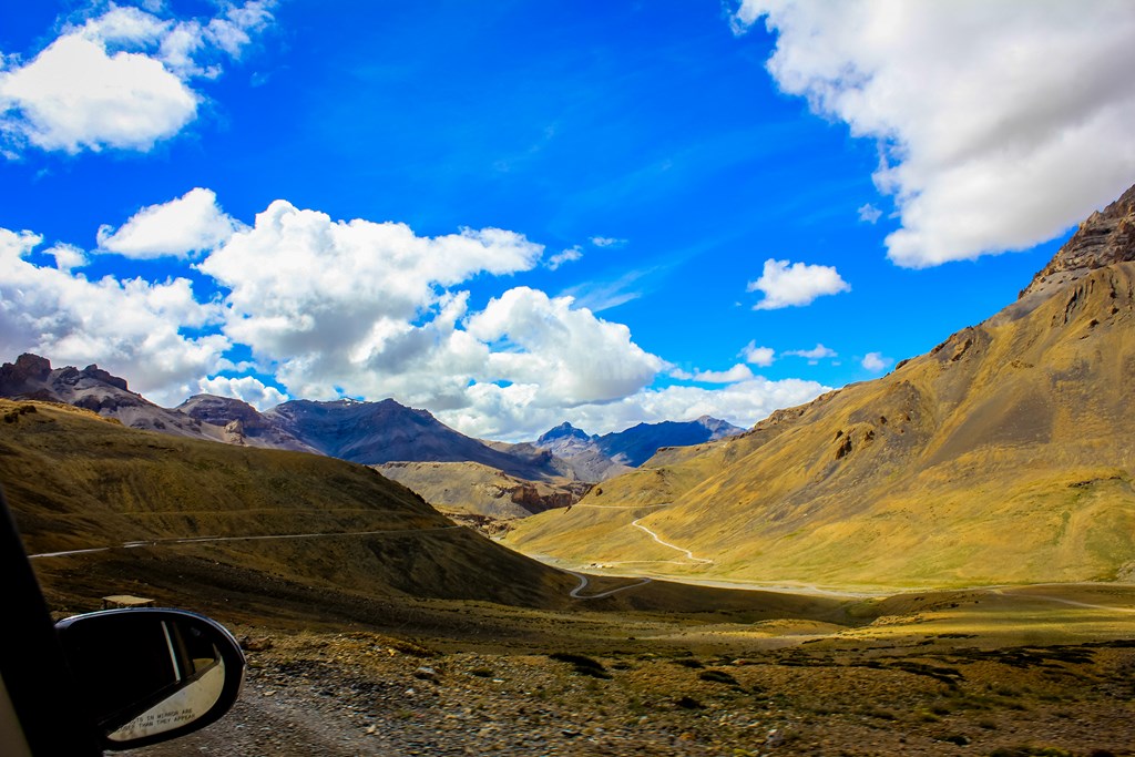
Soon we reach a vast open area with freshly laid tarmac going straight.. seems like a plan can take off from here. There are tracks parallel to the road.. We’ve reached Moore Plains! We too are inclined to take the tracks but then I remind that Moore Plains are part of wetlands that support the wildlife here and driving on tracks would be destroying their natural habitat. Better sense prevails and so we decide to stick to the road. But the road itself is quite inviting to pick up speed, however, there are frequent depressions on the road, created so that water can cross easily. This also helps to keep a check at the speed… 🙂

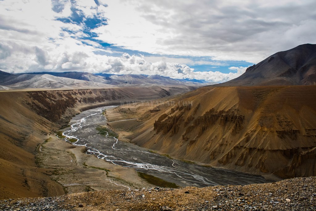
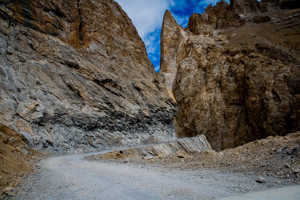
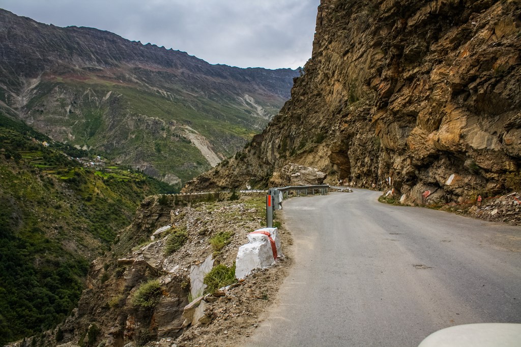
Passing through the Grand Canyon like structure, we soon pass the Pang check-post and reach Kanglajal bridge…

The army settlement and check-post


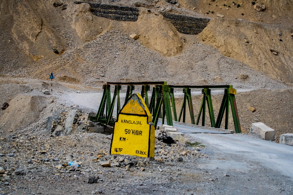
And just after the Kanglajal bridge is this arc made famous by travelers. Why it is famous? No body knows. Every traveler clicks a picture of it and I’m no exception. I thought of getting a pic beneath the arc, but time is a constraint. Some other time perhaps… some other time…
And the Grand Canyon continues…
Shortly after, the valley opens a bit with a stream running along the road and we are welcomed by the Himalayan Blue sheep or Ibex.. a family of it grazing in peace. I get out of the car and go near them to get a shot. Surprisingly, they’re not too bothered…


And then we start ascending again.. and the snow is visible on the peaks..

The ascent is not too steep and not too much. Shortly, we arrive at another mountain pass – Lachlung La.

There is a group of cyclists from Noida attempting Manali – Leh. We spend some time clicking pics and chatting with them and then proceed ahead.

And then there is a descent. We notice some camps in the valley and then the road ascents again.
There are tracks going down directly to the camps and at this point, Tony and Avi decide to take it on foot while Cheena and I drive ahead to reach there…

The camps as seen from the tracks. The two standing figures are myself and Cheena
We deliberate of having something to eat, but then decide against it and we start the ascent again to reach third pass of the day – Nakee La.
Descending from Nakee La, we again see an ibex perched on top of a rock…
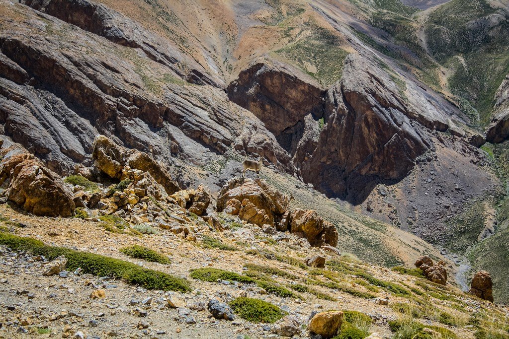

Closer look
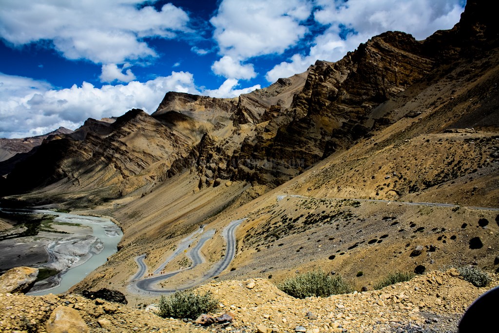
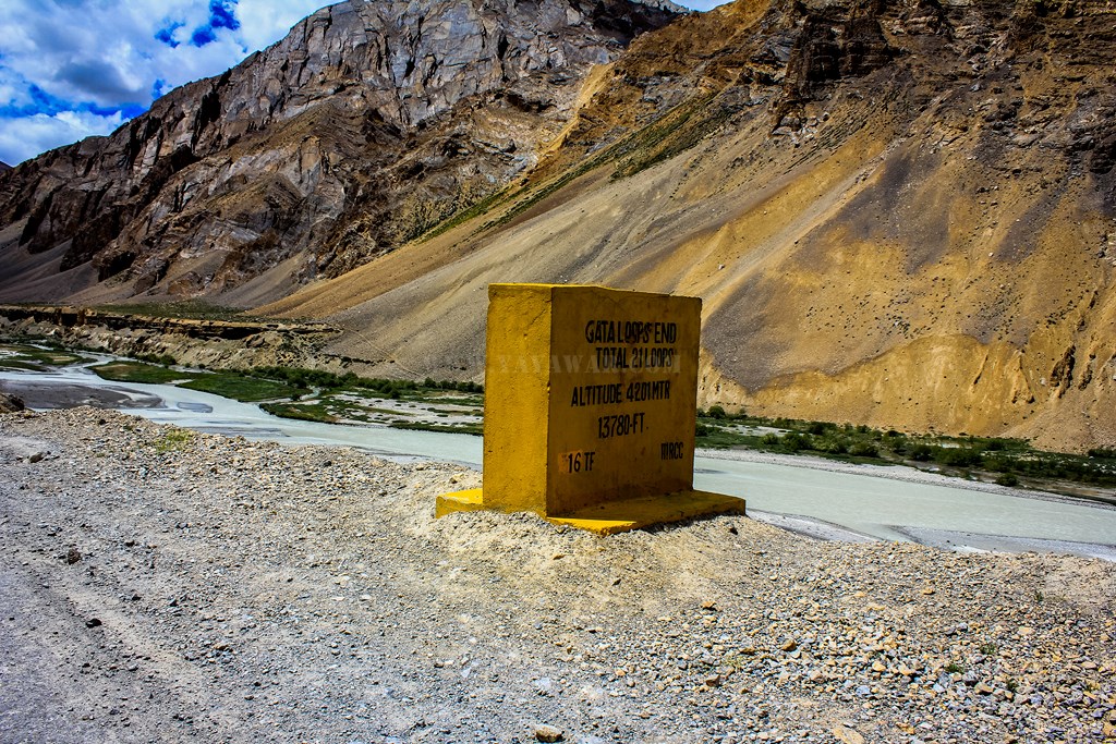
And shortly we come to the start of Gata Loops. Gata loops are 21 hairpin bends ascending/descending an altitude of 466 meters (4201 & 4667) in a span of about 9 kms. This could be tricky if you are ascending as normally according to the AMS rule, ascending a height of more than 500 meters isn’t advised, that too at the MSL of 4000+ meters.

Gata Loops have shortcut tracks also marked, however, we tamed the temptation of being adventurous and kept following the road. It took us just 18 minutes to negotiate the loops from the start marker to the end marker.

See those tracks?
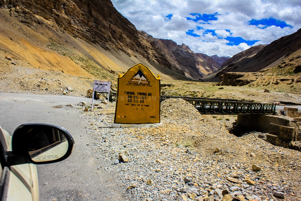
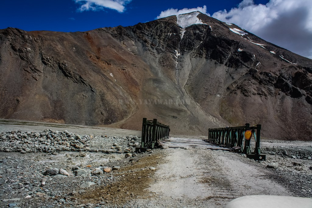
At the base of Gata Loop, there is a road that goes to Tsarap. We take the left fork to remain on Manali road. And then, we cross some bridges with funny names like Whisky Bridge, Brandy Bridge, and Twing Twing Bridge 🙂

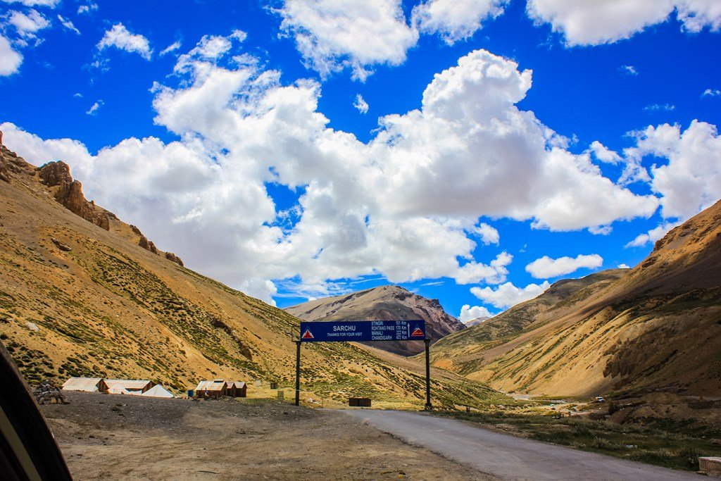
Soon we see some camps on the horizon and a board welcomes us to Sarchu (also know as Sir Bhum Chun, why – nobody knows!). There is a check-post at Sarchu since this place also happens to be where we would be entering Himachal now. The road is blocked with a thick rope. We go to the check-post and then we see something funny! The rope is remotely controlled! The person sitting at the check-post, which is about 10 mtrs further than the road, releases the rope sitting at his place itself and we cross over. 🙂 Quite a thought!!
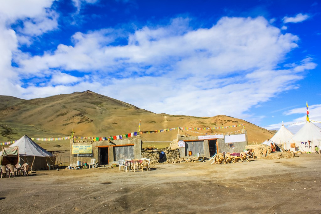
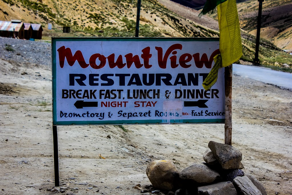
Just ahead, there are shops and camps. Some of the shops have clearly marked toilets with them and this is when we decide to freshen up… but not all of us. 🙂 We decide to have some maggi to eat now since it is already noon. The time reads 1245 hrs. We stop at the second last shop named Mount View. The owner is a Nepali who comes here every year.

Tony posing with the shop owner
So we have our fill of maggi and tea, and then we proceed ahead. Sarchu is also the place where Project Himank of BRO hands it over to Project Deepak of BRO.

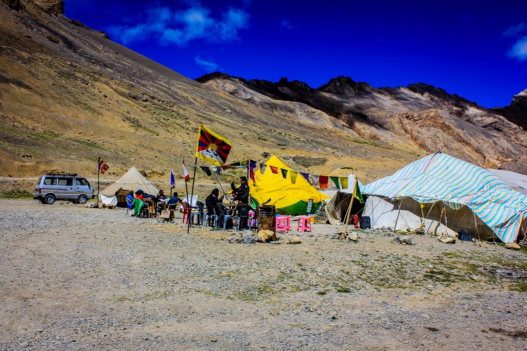
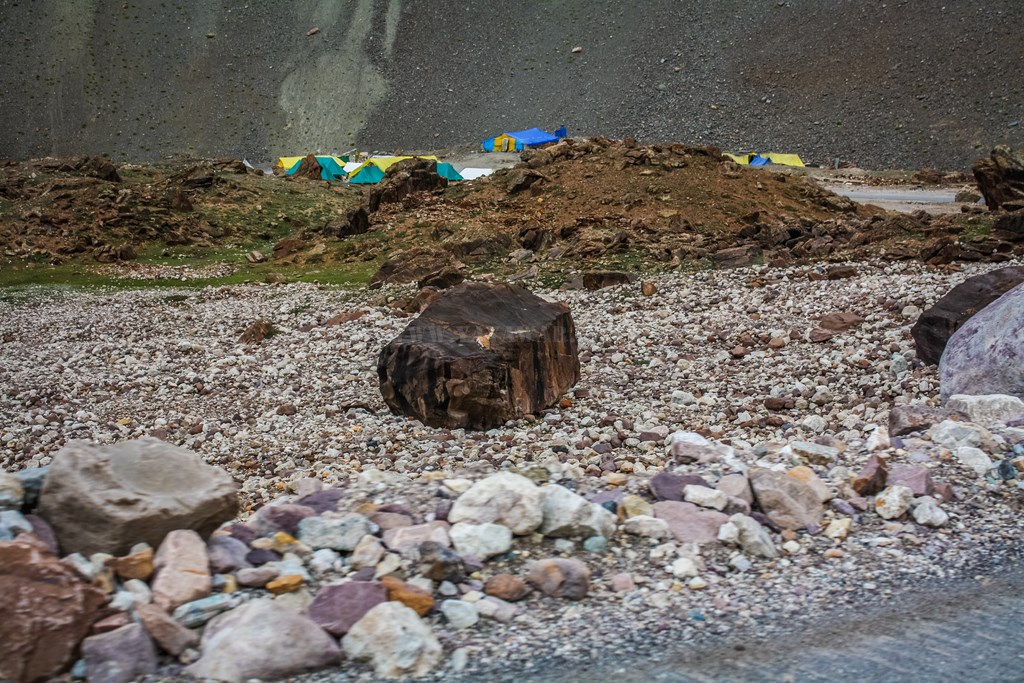
There are many options of tented accommodation at Sarchu, colourful ones…

Driving ahead from Sarchu, we approach Killing Sarai. Fortunately, the dilapidated bridge is functional today and we don’t have to cross the river through it’s bed. By the way, when the bridge is not functional, the place is indeed true to it’s name and generally, a BRO crane remains on standby here to rescue stranded vehicles! 😀
We start ascending again and now we reach the forth mountain pass of the day – Baralacha La. The Baralacha La is more of a plateau where three mountain ranges – Pir Panjal, Zanskar and the Himalayas meet at an altitude of 4890 meters. In ancient times, it was part of trade route with roads from Lahaul, Spiti, Ladakh, and Zanskar meeting here. Bhaga River flows on the North West, while the Chandra river flows South East. These two river meet after Keylong near Tandi and thereafter is known as ChandraBhaga river (not to be confused with Chandrabhaga river flowing in Amravati in Maharashtra) and further becomes Chenab river when Marau river meets it near Kishtwar. Further, Jhelum, Ravi, Sutlej and Beas, finally meeting Indus river while it flows in Pakistan. The base of Baralacha La is having a beautiful emerald coloured lake – Suraj Tal (Sun lake, also known as Vishal Tal), the source of the river Bhaga.

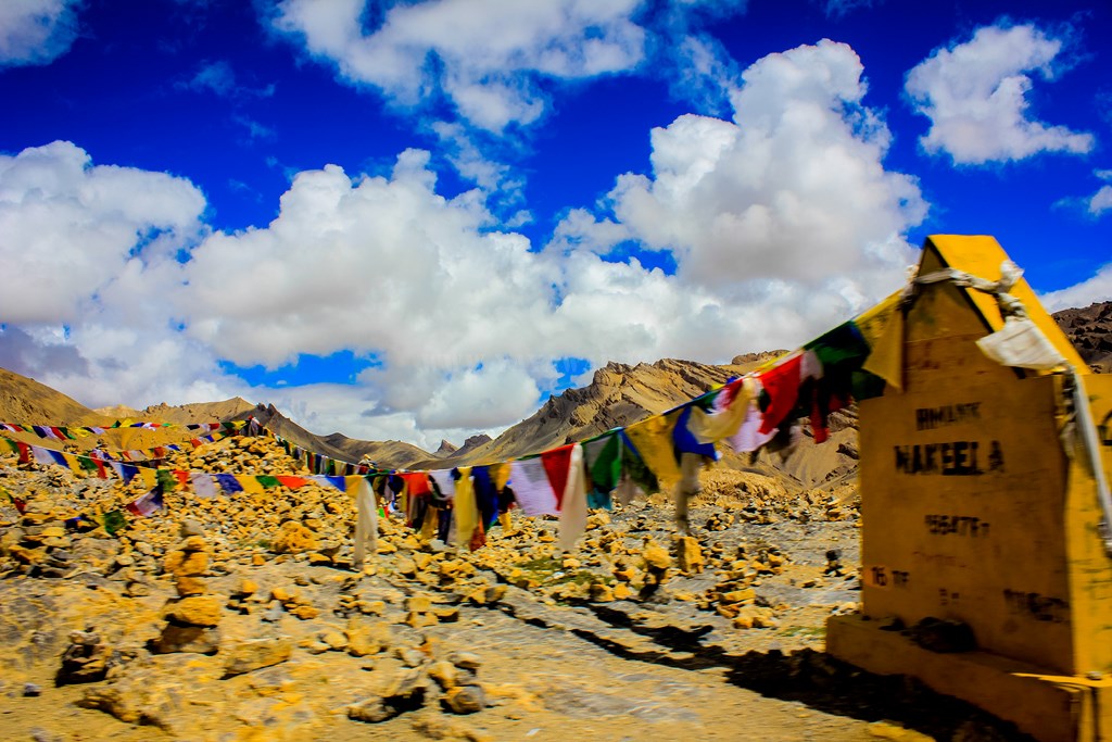
Prayer flags marking Baralacha La pass

Suraj Tal from a distance

The snow clad peaks – zoomed
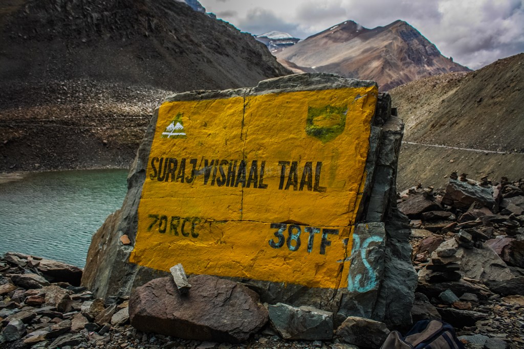
Suraj Tal
We see some new colours…
Ahead of Suraj Tal, there is a big water crossing…

And then we reach Zingzing Bar. Well, it’s not a bar akin to it’s name, rather just a BRO camp and some dhaba/shops where you can have tea/munchies. However, the name Zingzing Bar sounds a bell in my mind always, with a song (goes – Zingzing baaaar… Zangbo!). Actually it was from a children movie that I saw in childhood about a boy and his dog in hills and the adventure they go through. The dog in the movie was named Zingzing Bar. It’s always good to refresh childhood memories and hymn the song. 🙂
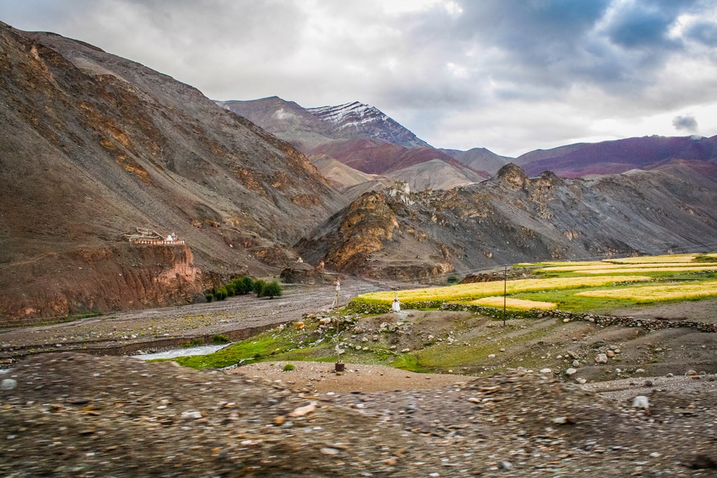
Mapping more miles, crossing some more water crossings, we pass by Darcha and Jispa with Bhaga river giving us company…

That’s around Jispa!

Finally around 1610 hrs, we reached the outskirts of Keylong which was marked with a big muck dumping site and slush all over the road for over 500 meters.

There is a road going downwards to the town and going by intuition, we take that road, for there is no space to stop and walk to anyone – it’s muck everywhere! While going down, we do ask a person about HPTDC Hotel Chandrabhaga and he directs us further down towards the Bus Stand. So we drive ahead and enquire about it. By the time someone is able to give us the coordinates and directions, we’re already pas the bus stand in the market which is too narrow and congested. With some difficulty, we manage to turn the car and go back to the point from where we drove down and then take the highway. Hotel Chandrabhaga is on the highway itself! The time is 1630hrs.
We park the car and go to the Manager, who is sitting outside on a chair at the gate itself and enquire about room availability. It’s all available, he says. HPTDC is mainly used by people availing the HPTDC bus service from Manali to Leh for the night stop. The last bus to Leh left this morning itself and now it would return tomorrow, so it’s all available with just only one more guest in the entire hotel. So we get a duplex suite so that we all can be together and it has nice views too! Primarily, all government owned properties are at vantage points and so is HPTDC Chandrabhaga! The cost here includes lunch, dinner and breakfast too, so we ask for Lunch, having eaten just a bowl of maggi during the entire day. Food is hot and tasty, and for the first time since Kargil (8th day!), we are having proper food to eat. Tea comes next. The service is excellent and rooms are clean. In fact I’d recommend Hotel Chandrabhaga to anyone aiming to spend the night at Keylong.
When the stomach is contented, I talk to the manager. Bhatia Saab is the Manager and belongs to Patiala in Punjab. For the six month that Rohtang and Baralacha La are closed, he serves in the lower Himachal, at places like Mandi.
Next we get down and inspect our car. With the original gas burner gone, we had purchased a single burner stove. For camping preparation at Chandratal, we thought of testing the setup. Lo! The regulator broke! Now to search the regulator, me and Avi go to the lower bazaar which is good 1/1.5 km downhill. We got the regulator and then the arduous task to climb steep uphill was some task in itself. Testing the setup, we recognize that the pipe won’t fit the regulator. Now another trip to the market to get either the appropriate pipe or a regulator. Who wants to go? At least I don’t!! So Tony and Avi go for it. They return empty handed as the market has closed down as the darkness is descending and the hills close early.
We spend some time getting fresh and having bath. It has been so long that we’ve taken bath.. not since we left Leh. Turtuk was all tented accommodation. We could have taken bath at Serthi, but with the luxury of two buckets of water over 4 persons for everything, we couldn’t. Why two buckets? Read it here. Pangong again was tented accommodation only and at Upshi, it was “Bahar Accha”. So this was our opportunity to bath properly after 4 days, and we used it fully!
While we were getting ready for the dinner, Vishawas (who Vishwas?) called up to inquire where we were. When we told him that we were at Keylong, he exclaimed that they too were at Keylong itself, in some other hotel. He wanted to sync plans for Chandratal and hence I asked him to come over. Shortly, he came over with his friends. What he told was amazing! They had left Leh on 15th itself and stayed at Hunder. The next day, they went to Sakti through Wari La, camped there in their own tents in the campus of their driver’s friend. Next day, they camped in their own tents at the Pangong shore. Went back to Leh the next day and did river rafting and then visited Tso Moriri the next day and now are at Keylong. They did enjoyed the full trip!! Only now Vishwas told me that the driver was hired till Keylong only since two of them will be returning back to Leh, and 2 would want to go to Manali and back to their home, which leaves only him and one more friend for Chandratal. We didn’t had space in our car and so they decided that they’ll go to Manali and then hire bikes from there to come to Chandratal.
Finally we see off them and have our dinner and then we go to sleep. Tomorrow will be a relaxed day as there is not much driving involved…
Next: Keylong to Chandratal
CONTD…
Total Distance covered: Approx 312 kms
Driving Directions from Upshi to Keylong: From Upshi tri-junction, take the right fork to go towards Manali. The left fork goes to Tso Moriri via Chumathang. Cross the bridge on Indus and the Indus leaves you. Drive straight to pass by Miru, Lato, Gya, and Rumtse and ascend to Tanglang La. Descend further to reach Debring. Ahead of debring, take the left fork to remain on Leh-Manali highway, the right goes to Tso Kar. Keep driving on to pass by Moore Plains, Pang, Lachulung La, Nakee La and descend through Gata Loops. At the end point of the Gata loops, take the left fork towards Manali, the right fork goes to Tsarap. Keep on driving to pass by Sarchu – the Himachal Border and then Whisky Nalla, Killing Sarai, Baralacha La, Suraj Tal, Zingzing Bar, Deepak Tal, Darcha, Jispa and reach Keylong. At Keylong, do not take the left fork going downwards towards the town, rather keep on the highway itself and arrive at HPTDC Hotel Chandrabhaga.
Google Map directions for Upshi to Keylong travel: http://goo.gl/maps/M2FBe


What an exciting journey this must be… Super awesome !
Thanks VJ for stopping by. Indeed it was a super-exciting journey. Over an year has passed and I’m still re-living every moment of it 🙂