
Day 11: 19 August 2013: Part 3: Merak to Chusul
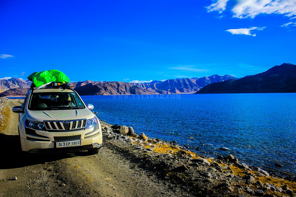
After finishing the formalities at the Merak checkpost, we proceed ahead towards Chusul. The time reads 0945…
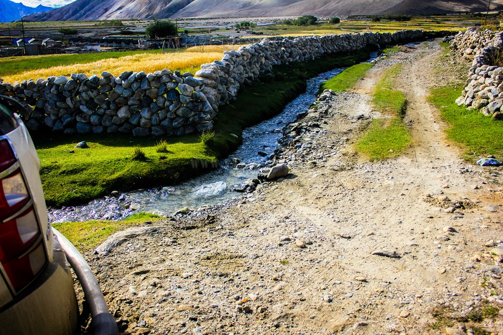
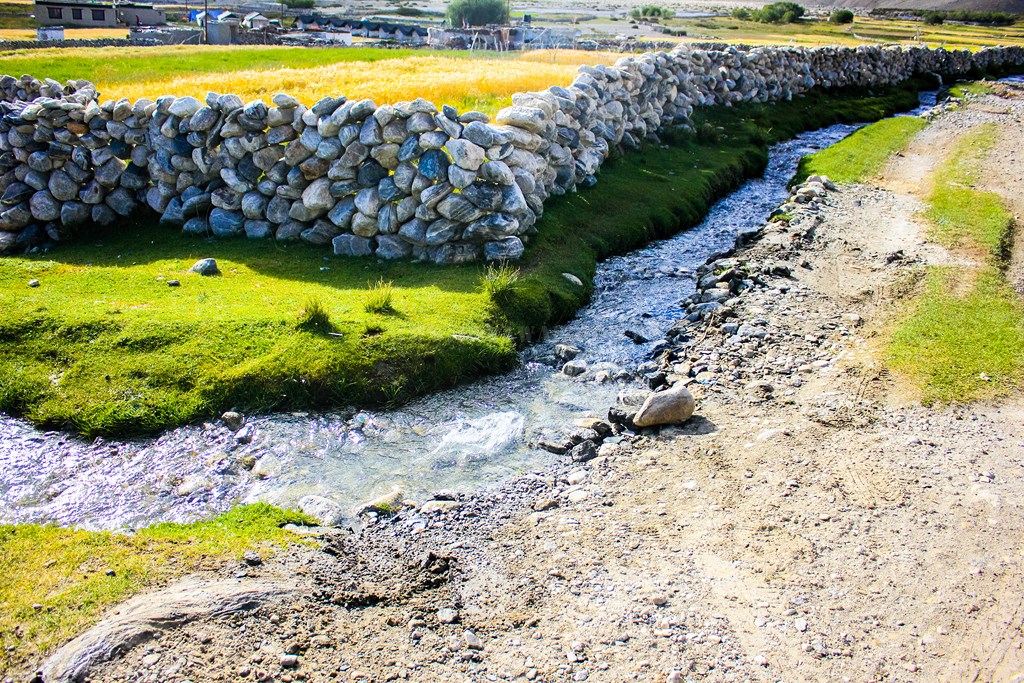
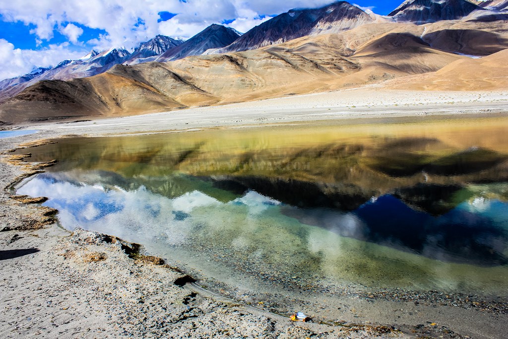
Many streams from nearby glaciers are coming and merging into Pangong creating a wetland sort of…

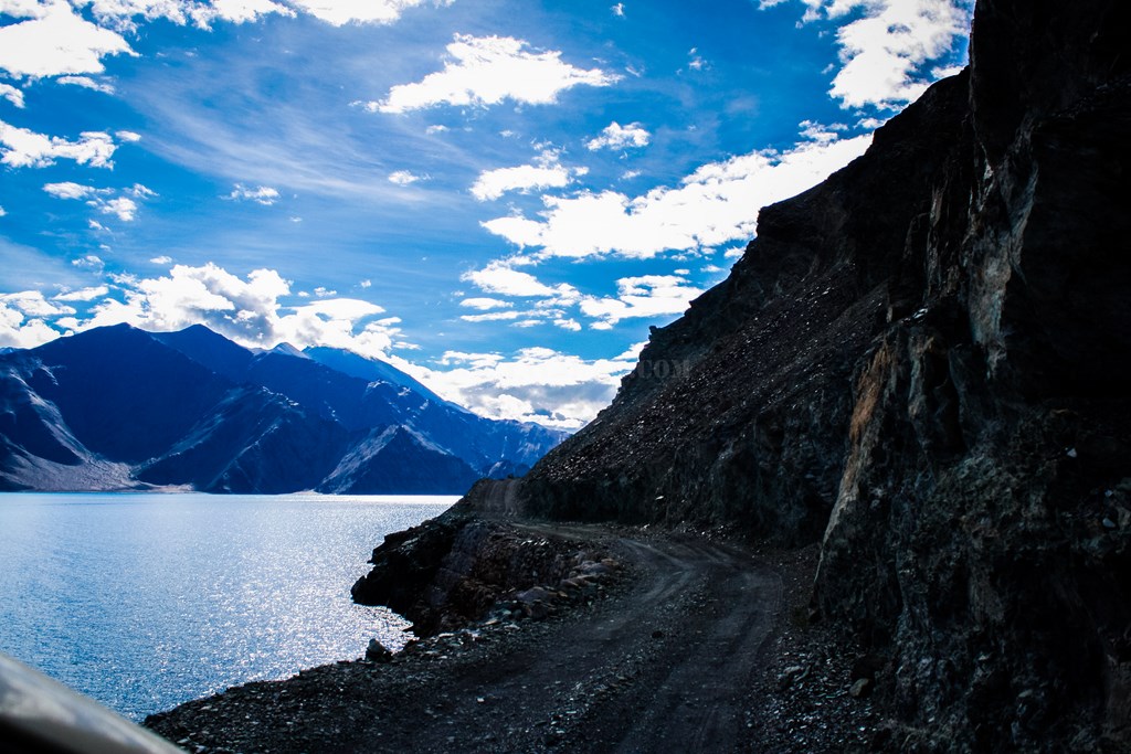
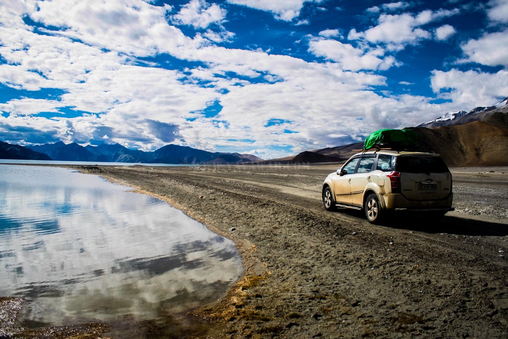
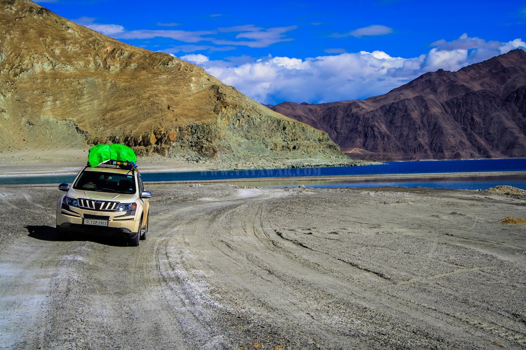
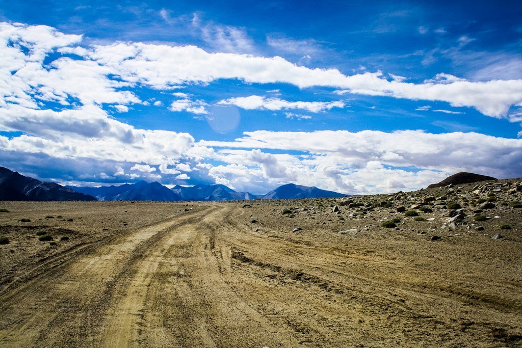
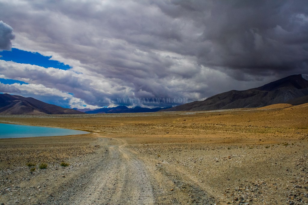
And yes, there are still no roads, just tracks and that too has detoriated further.. pebbles have given way to rocks…

The terrain is tough and sometimes takes it’s toll on the vehicles passing. One such evidence when the toll was collected from Government of India! 😀

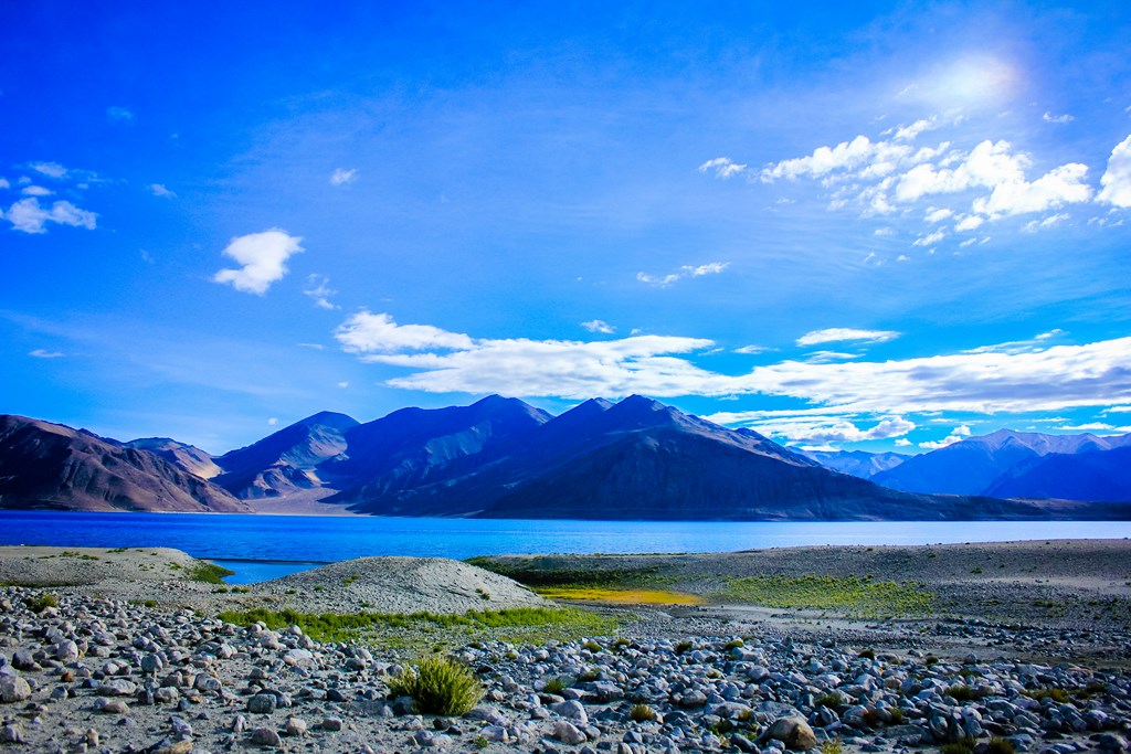
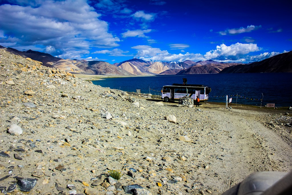
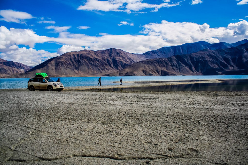
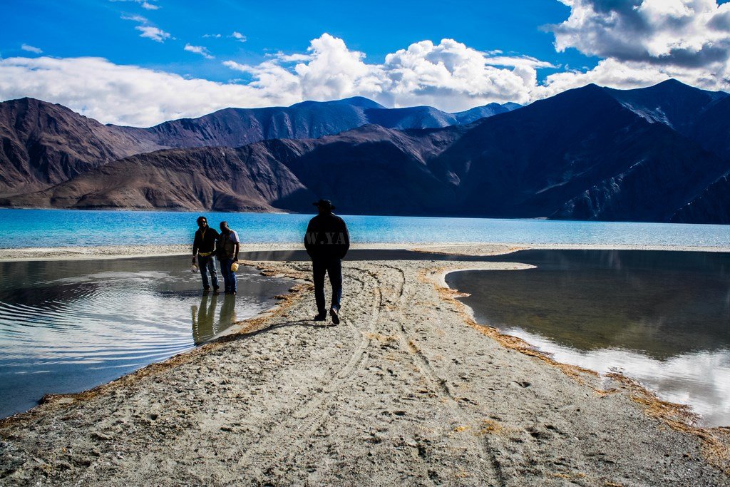
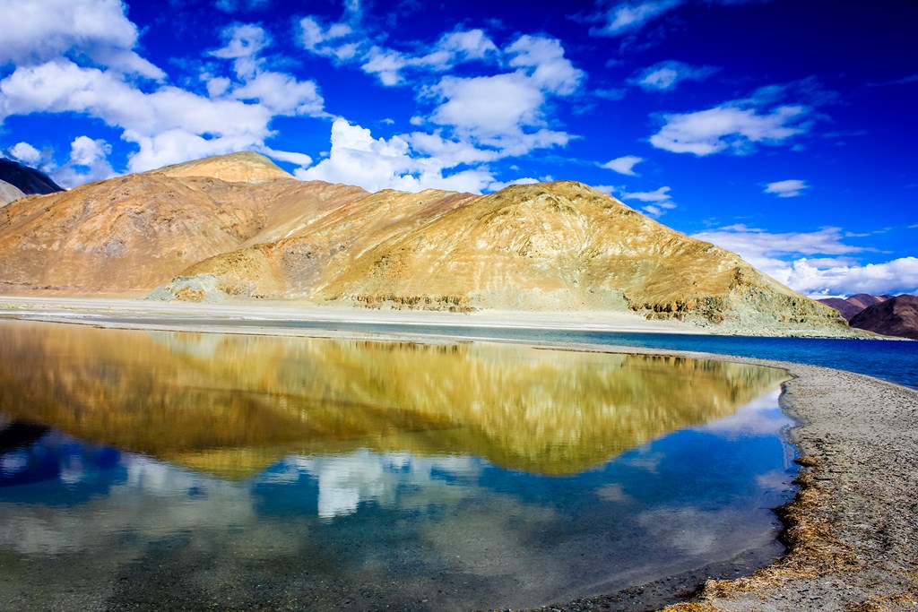
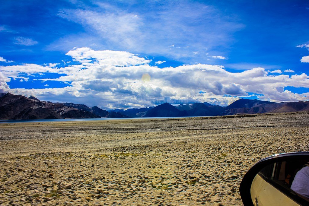
And the terrain continues along with the Pangong
And then we come across a roundabout on our way to Chusul, though there is no one crossing the road except for a glacial melt stream..

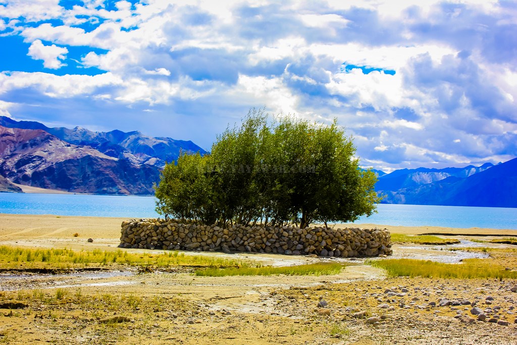
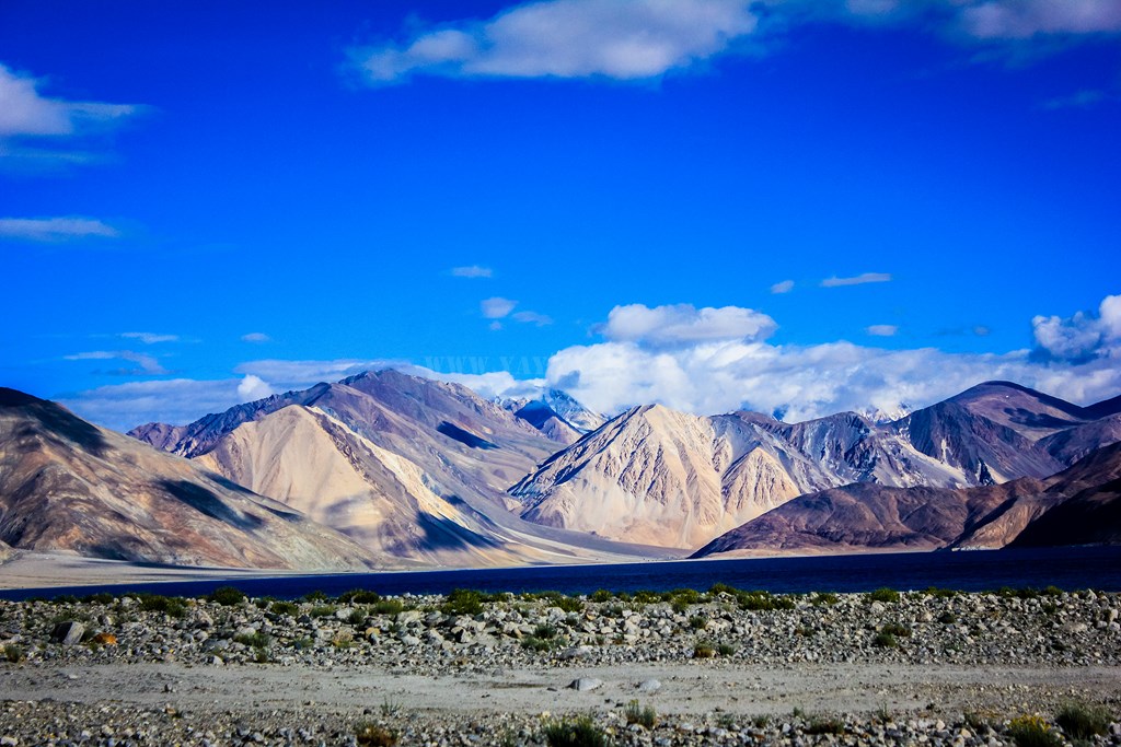
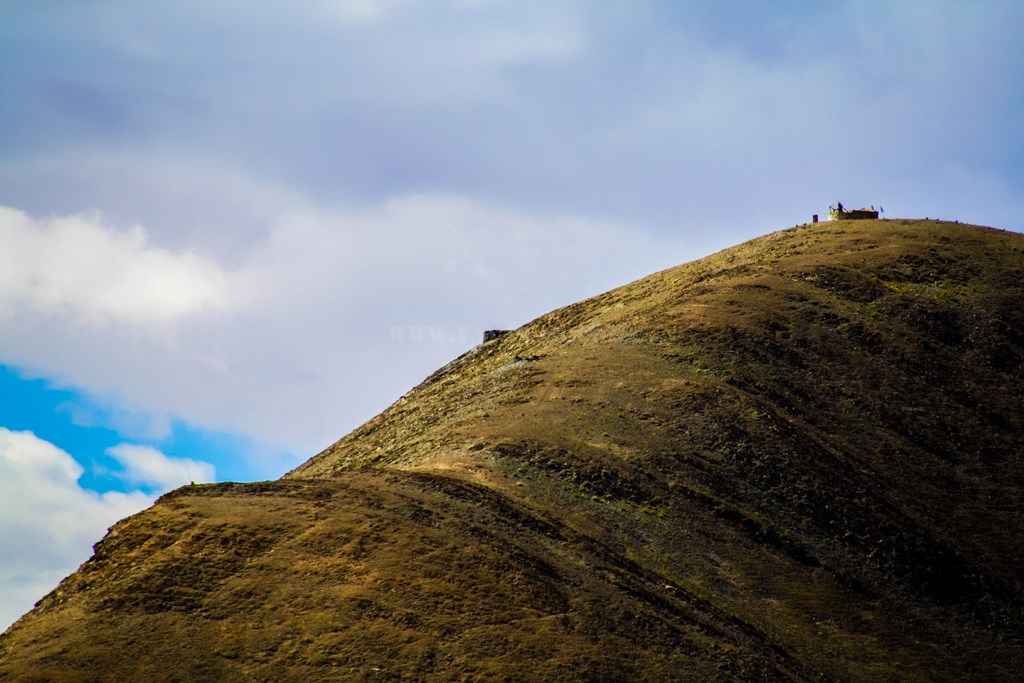
The setting is awesome! Snow clad mountains, barren landscape with bits of oasis spread around, and of course the Pangong running along.

We come across another settlement, perhaps the last one before we reach Chusul – Khaktat/Kakstet it is!

The clouds are hovering again, and we continue our drive..,
There is some work going on the Chinese side, perhaps they’re building a metalled road…
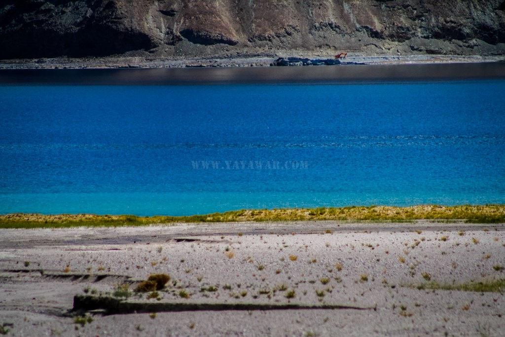
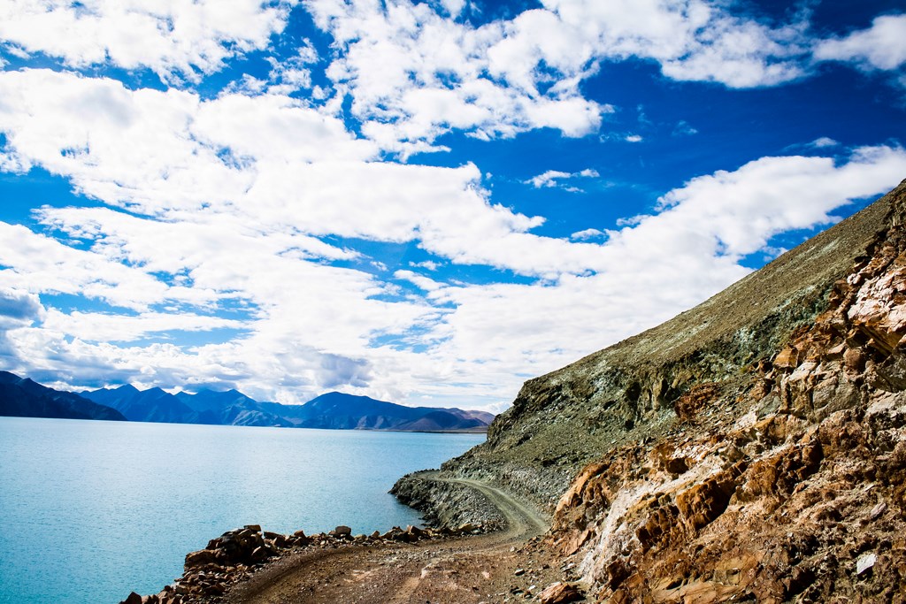
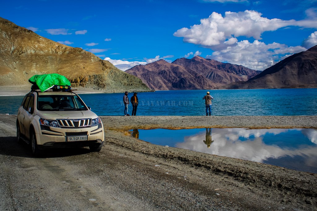
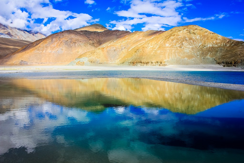
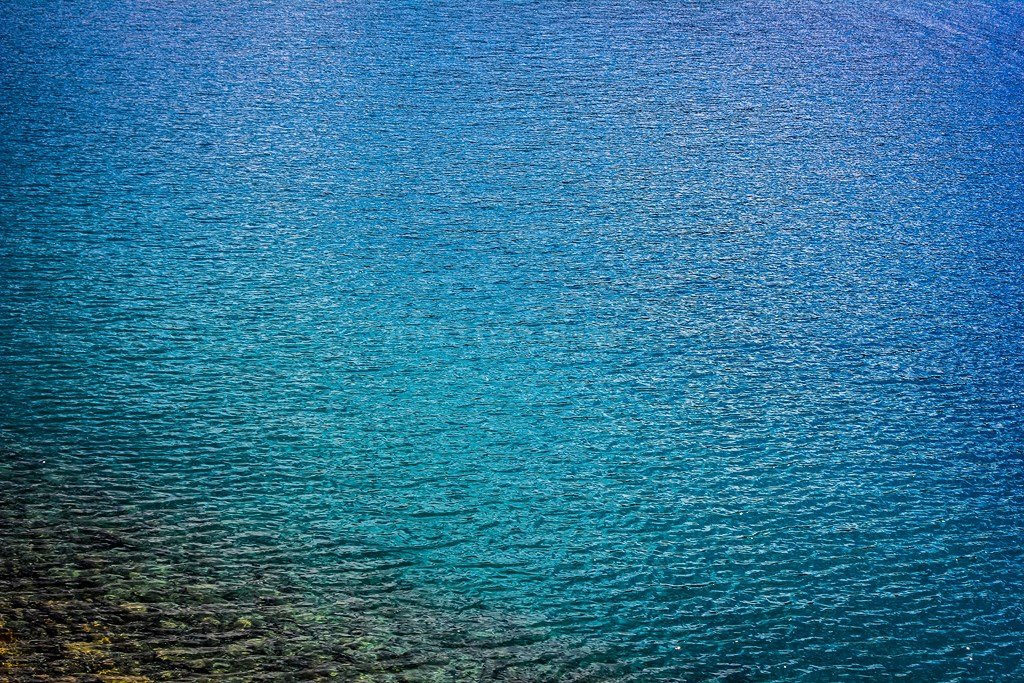
The Pangong is exhibiting variant colours at the same time…
And the lake appears to be turning to the left, into China perhaps… We have to keep right now, lest we want free Chinese food for life 😉

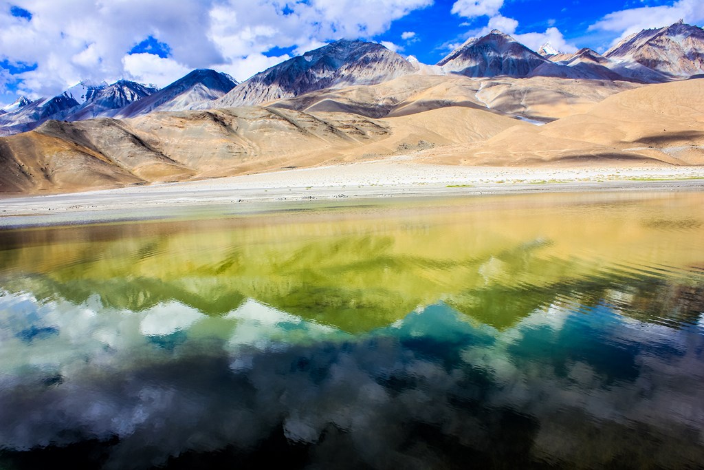
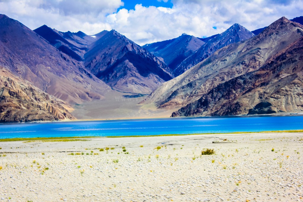
The mountains are towering on the right, snow clad and displaying varied colours…

And then we spot a native – the Kiang or the Ladakhi wild ass

And wild horses in droves…

I click some wild flowers while Cheena is driving..

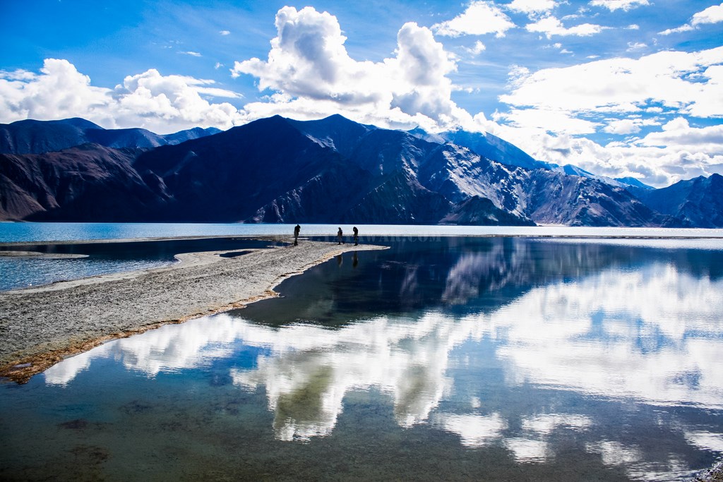
And now the Pangong finally takes a turn to venture into China. Perhaps this is the last view of Pangong that we would be able to see…

As we go right, we meet some more horses. They appear to be wild, but then we notice bells tied to their neck. But the owner is nowhere to be seen.


All the while, we are gradually ascending after Kakstet which wasn’t too evident, but now the ascent is evident..

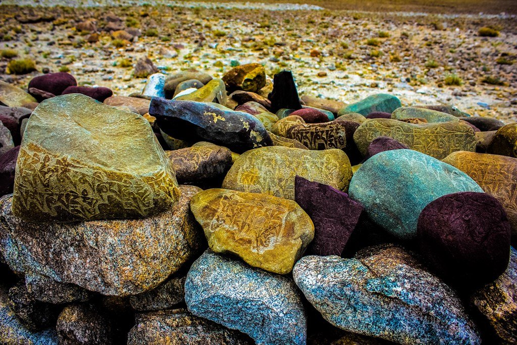
After ascending a bit, we come across a flat chorten (or is it a memorial?) with lots of stones carved with the Buddhist Mantra – “Om Mane Padme Hum”. We get down to click pics from close..
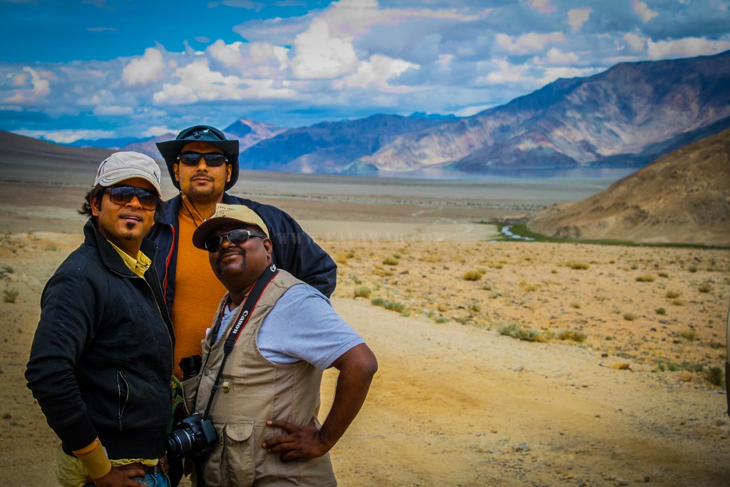
This is when we turn back and realise that this would be the last view of Pangong on the way to Chusul.


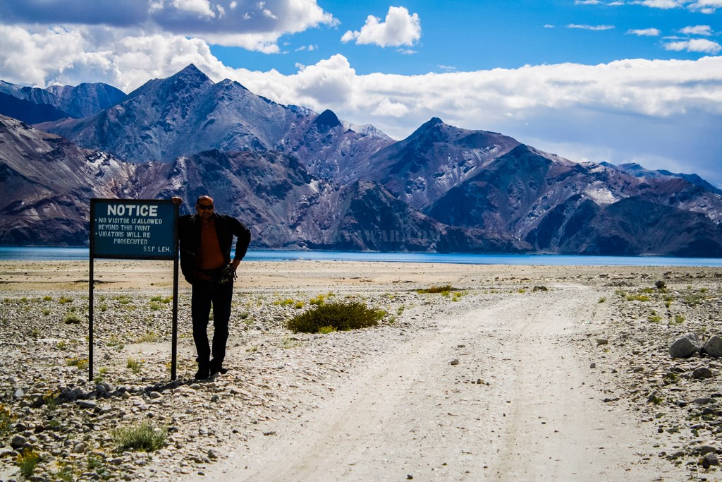
And so we get ourselves clicked – the “I was here too” pic 😀
I take this opportunity to click some macros, while Avi clicks me in the act!

The result:

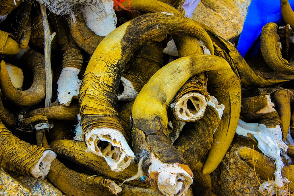
Driving ahead, we find a plateau area and then ascend again. What we see appears to be a pass, marked by prayer flags. Strangely enough, it is not just the rocks that mark this pass… and there is no marker or the name given to this pass (Had known about a pass marked with horns called Polakang La, but that is on other route! Later learnt that People call it various names including Chusul La)

This pass mark is chiefly comprised of horns – perhaps Yak horns!
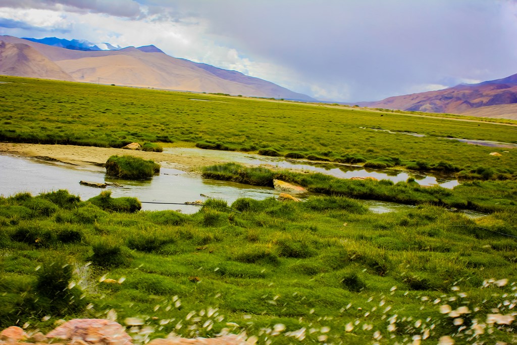
Shortly ahead, a board announces the area ahead as breeding ground for migratory birds, and the wetlands start…

And I click yet another carcass…

The wetland is vast with multiple streams running in…
And then the village boundary appears.. the mountain besides the village has a huge ITBP motif painted on it.

And finally we see remains of a metalled road. We’re quite happy to come out of the dirt track marking the path all the while from Spangmik to Chusul!

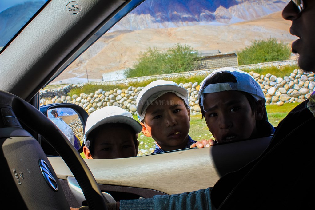
We pass by houses and click some kids happily waving towards us…

And also pass by a Jat Memorial.. perhaps Army had a presence here sometime..

As we enter the village and drive towards the checkpost, a couple of people wave us to stop. One of them asks for our ILP and on enquiring he says that since people rarely come to this route, he has locked the checkpost and going to his home for lunch. He keeps a copy of the ILP, but says perhaps we will not be allowed to go further by ITBP. What the hell? We have the permits for both Tsaga La and Mitpal Tso routes and he’s not stopping us. We’ll pass by. Our plan is to take the Mitpal Tso route to Tso Moriri, which is barely 100 kms from here and we shall be able to reach Korzok by the evening as the time reads 1245 hrs.
We drive ahead where there appears to be a gate, with a sentry post and some ITBP personnels manning it. The road to Tsaga La goes to left, without entering the gate. The road to Mitpal Tso appears to be going via the gate and so we’re confused as there are army trucks parked just after the gate and we think that we should not be entering sensitive area without permission. So we stop the car and go to the person to enquire the way to Mitpal Tso.
The person is a Sikh and shows us the road going through the gate, but says we can’t take the road. Says that they have strict instructions not to allow anyone on either the Tsaga La or Mitpal Tso route and that we have to go back! Not sure whether he cooked up a story, but said that yesterday, they had allowed a family on a SUV to take the Mitpal Tso route and they had three tyre bursts on the way and eventually they had to be brought back and hence they’re not allowing. And of course taking Tsaga La is out of questions. I reason with him that we’ve got the ILPs and shall be permitted, but he says that his CO has ordered him so and only he himself can revert his orders. I ask him if we can visit the Rezang La War Memorial at Chusul – the memorial built in memory of Major Shaitan Singh, Param Vir Chakra winner (posthumously). In the meantime, couple of more personnel join the conversation. They say that it is quite unfortunate, but we’ll not be allowed to pay our homage, unless the CO approves of it. They agree that this is not as it should be, but they’re bound by orders.
I ask them to let me talk to their CO. They try for couple of times, but the person doesn’t picks up. Now this is too frustrating. We are Indian citizen, we have all the required permits, but still our taking the passage is on the whims and fancies of someone who doesn’t even bothers to pick up the call placed by his own battalion! We talk to the personnels manning the place and explain that it has taken us hell lot of time to traverse all the way from Spangmik to Chusul and going back the same way would mean that we loose the entire day thus shattering our travel plan. He then says that we can take the route going from the gate, but not taking a left turn towards Mitpal Tso and that would take us to Tangtse via Erath, and that this is a metalled road. Seeing us frustrated, he says that if we wish, we can go till the Rezang La War Memorial, but will have to return after paying our homage. I ask them if anyone of them can accompany us as we don’t know the way and don’t want to be stopped and procecuted is someone else meets us, but they’re not free.
Not willing to take any chance, we decide to give it a pass and go towards Tangtse. The time reads 1220 hrs…
(Later on, after returning from the trip, I learnt that there was an alternate route within the Chusul village which would have alleviated the encounter with the ITBP personnels, thereby maybe creating a possibility of taking the desired route. Bad luck!!!)
Next: Chusul to Tangtse
CONTD…
Total Distance covered: Approx 26.5 kms
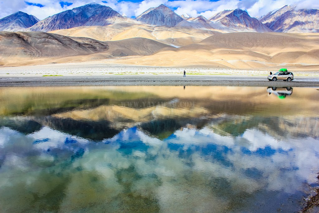
Driving Directions from Merak to Chusul: From Merak, follow the dirt track on sand and gravel following the Pangong shore and tyre marks left by other vehicles to arrive at Kakstet which is marked by a roundabout (photo above). From Kakstet, keep on the dirt track and when the Pangong appears to be turning left, follow the tyre marks to keep yourselves towards right, leaving the Pangong. Further on, there are sevaral tracks which all reach to the same marshlands before Chusul, just ensure that you’re not venturing too left. After the marshlands, metalled road starts after crossing a bridge and you take a right turn to enter Chusul village.
Google Map directions for Merak to Chusul travel: https://goo.gl/maps/dijIR